Marine Radar Explained: How Boat Radar Works, the GPS Overlay and Radar at Anchor
Radar is the one instrument on the boat that sees what is actually there rather than what a chart or a database says should be. The chartplotter draws rocks that were surveyed decades ago. AIS draws the ships that have chosen to transmit. Radar draws the unlit fishing boat, the buoy that dragged, the squall line and the ferry that has switched its AIS off, and it does it in fog at three in the morning. Here is how it works, what the spec sheet numbers really mean, why the overlay on the plotter needs a heading sensor and not just GPS, where AIS fits, and the guard zone trick that turns the radar into the second anchor watch that can see other boats.
The short answer
A marine radar sweeps a microwave beam round the horizon and times the echoes: time gives range, antenna angle gives bearing, and the display plots each echo with your boat in the centre. It needs no GPS to see; GPS and a heading sensor come in only to lay the picture over the chart and to work out a target's true course. Real range is set by the radar horizon, about 2.2 × √(antenna height in m) nautical miles, not by the number on the box. For a boat under 50 ft buy a solid-state radome, run it on a short range, learn gain and the two clutter controls, use the EBL for the steady-bearing test, and set a guard zone: a sector on passage, a ring at anchor.
Radar, AIS, GPS and the Lookout: Who Sees What
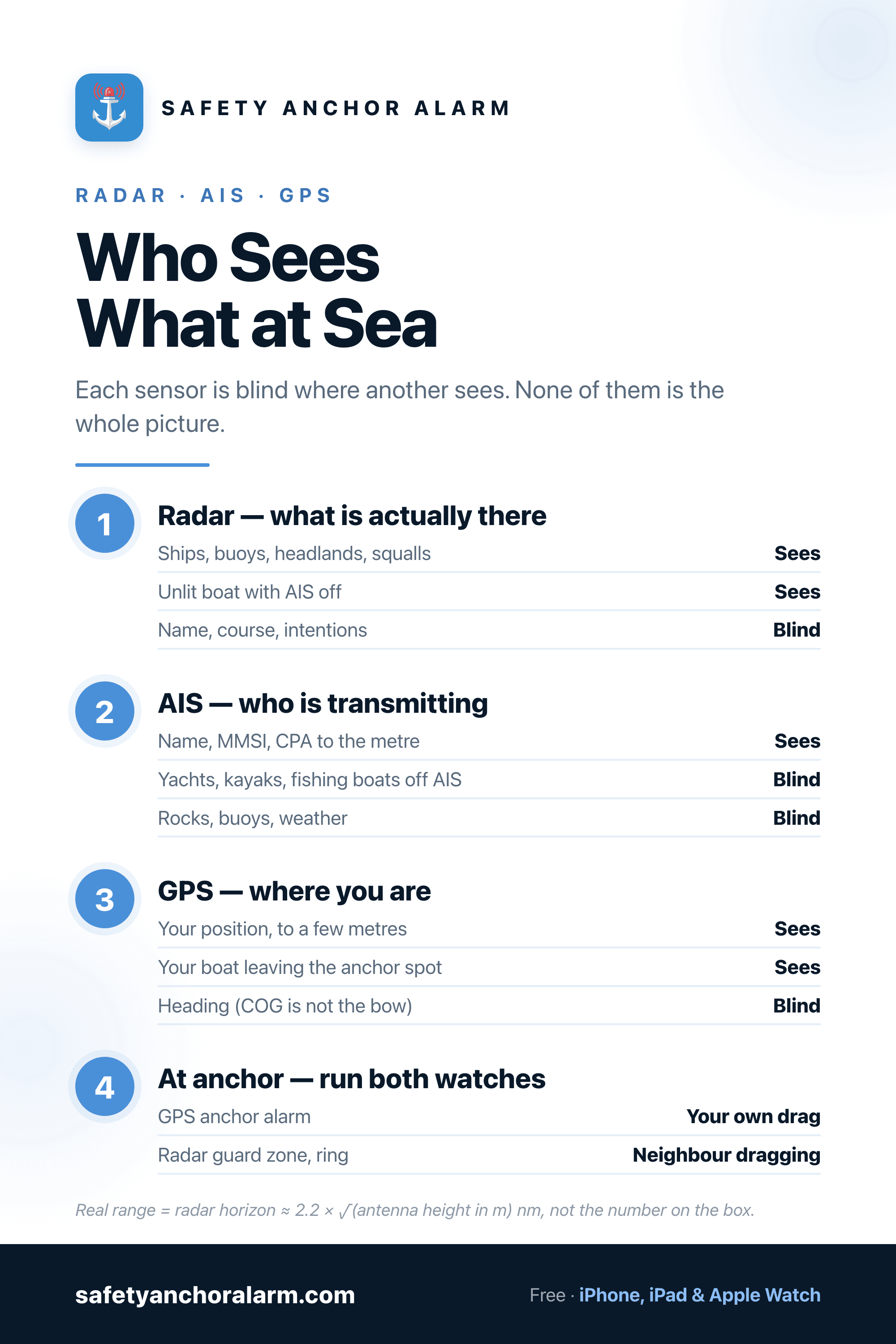
The four sensors on a small boat are not rivals; each one is blind where another sees. The mistake is to treat any of them as the complete picture.
| Sensor | Sees | Misses | Its job |
|---|---|---|---|
| Radar | Anything solid that reflects microwaves: ships, buoys, headlands, rain, a dinghy on a good day | Small low targets in sea clutter, anything below the radar horizon, a boat's name and intentions | The sensor for fog, darkness and the traffic that does not announce itself |
| AIS | Every vessel transmitting: name, MMSI, course, speed, closest point of approach, beyond the horizon and round a headland | Boats with no transponder or with it switched off, rocks, buoys without AtoN beacons, weather | Identity and intentions of the ships that are transmitting; the one you call by name on the VHF |
| GPS / chartplotter | Where you are, to a few metres, on a chart that shows where the rocks are supposed to be | Anything that moves, anything not on the chart, and whether the chart is right tonight | Position and navigation. Also the sensor an anchor alarm runs on, because at anchor the only thing you need to see move is you |
| Eyes and ears | Lights, shapes, sound signals, the loom of a headland, the squall line coming | Everything in fog beyond a boat length | Required by COLREGs Rule 5 whatever else is switched on. The electronics are there to inform the lookout, not replace it |
How Radar Sees
The name is an acronym, radio detection and ranging, and that is the whole method. An antenna in the radome or on the open array sends out a short burst of microwave energy, in the X-band at about 9.4 GHz for every leisure-boat set, then listens. Anything solid in the beam sends a fraction of that energy back. Radio waves travel at a known speed, so the delay between the pulse going out and the echo coming back is the range: a target one nautical mile away answers in about 12 microseconds. The antenna rotates, typically 24 to 48 times a minute, so the set knows which way it was pointing when each echo arrived, and that is the bearing. Range and bearing from your own boat, plotted on a screen with you in the middle: that is the radar picture.
What comes back depends on the target. Steel ships and cliffs return a strong echo. Fibreglass, wood and a low sandy beach return almost nothing, which is why a sailboat without a reflector can be invisible and why a coast that is bold on the chart can be faint on the screen. Rain returns a diffuse echo of its own, which is a nuisance when you are looking through it and useful when you want to know where the squall is. The beam is not a pencil: a small radome throws a beam about 4 to 6 degrees wide, so two targets close together at the same range merge into one blob, and a headland smears wider than it is. A longer open array narrows the beam to 1 or 2 degrees and draws a sharper picture; that is the real thing the extra money buys.
Pulse, Solid-State and What the Spec Sheet Means
Until about 2010 every small-boat radar used a magnetron, the same tube as a microwave oven, firing kilowatts of power in very short pulses. Magnetrons need a couple of minutes to warm up, wear out over a few thousand hours, draw a lot of current, and are blind for the first few tens of metres because the receiver has to be shut while the pulse leaves. Solid-state radars (Navico's Broadband and Halo, Garmin's Fantom, Raymarine's Quantum, Furuno's NXT) transmit a few watts continuously or in long coded pulses and use signal processing instead of brute power. They switch on instantly, draw a fraction of the current, see a mooring buoy 20 m off the bow, and most of them add Doppler: echoes moving towards you are coloured differently from echoes moving away or standing still, so the one boat in the anchorage that matters lights up.
The number on the box is nautical miles of maximum range: 24, 36, 48, 72. Read it as a description of the transmitter, not of what you will see. Radar is line of sight, and the earth curves. The radar horizon in nautical miles is about 2.2 times the square root of the antenna height in metres, and the target gets the same allowance for its own height. A radome 5 m up a sailboat mast has a horizon of about 5 nm; add a ship's 25 m superstructure and you will pick her up at 15 nm or so, but a 1 m buoy will not appear until it is inside 7 nm, whatever the box says. Raising the antenna buys range. It also raises the beam so that close targets fall beneath it and the boat's motion sweeps the picture about, which is why a sailboat radome lives on a mast bracket or a stern pole at 4 to 6 m and not at the masthead.
Power draw matters on a boat that anchors. A magnetron set transmitting all night can pull 3 to 5 A at 12 V; a solid-state radome in a timed or low-power standby mode a fraction of that. If you intend to run a guard zone at anchor, which is where this article ends up, that difference decides whether the batteries are flat by morning.
Reading the Picture: the Six Controls
Auto modes are good enough that a new owner can leave every control alone and see ships. They are not good enough for the situations that make you glad you have radar: a small target in a sea, a harbour entrance in rain, an anchorage full of boats. Six controls do the work.
| Control | What it does | How to use it |
|---|---|---|
| Range | How far out the display reaches | Keep it short when it matters: 3 nm to work a harbour approach, 6 to watch traffic, 12 or more only to look for ships early. A short range shows detail; a long range hides a small boat in a single pixel. Flick out and back every few minutes. |
| Gain | Receiver sensitivity | Turn it up until a faint speckle just appears across the screen, then back off a touch. Too low and small targets vanish; too high and noise fills the picture. Auto is fine offshore, manual when it is busy. |
| Sea clutter (STC) | Suppresses echoes from waves close to the boat | Add only as much as clears the bright doughnut around the centre. Every notch also removes small real targets at the same range. On a rough night the kayak and the wave look the same. |
| Rain clutter (FTC) | Thins out the echoes from rain and squalls | Use it to see through a shower to the ship behind it, then take it off again. A squall is a target worth watching in its own right; the rain clutter control hides it. |
| EBL and VRM | Electronic bearing line and variable range marker | Put the EBL on a target and watch it. If the bearing does not change and the range closes, you are on a collision course, which is Rule 7 in one sentence. The VRM measures the distance to a headland or your anchor swing. |
| Guard zone | An area that sounds an alarm when an echo enters it | A sector ahead on passage, a full ring at anchor. Set it wide enough to give you time to react and tight enough not to trip on every wave. This is the control that lets you sleep. |
Two habits make the difference between owning a radar and using one. The first is to look at it in good visibility, on a sunny afternoon with the coast in plain view, so that you learn what a headland, a buoy, a ferry and a fishing boat look like on your set before the day you have nothing else to look at. The second is to keep changing range. A radar left on 12 nm shows the big picture and hides the kayak; a radar left on 1.5 nm shows the kayak and the ship appears with no warning.
Where GPS Comes In: the Overlay, MARPA and the Heading Sensor
A radar by itself draws echoes relative to the boat: ahead is up, and if you turn, the whole picture rotates. That is head-up and it is the simplest way to see what is in front of the bow. The moment you want the radar laid over the chart on the plotter, or want targets to stay put on the screen when you alter course, the set needs to know two things it cannot measure itself: where you are and which way the bow points. GPS supplies the first. Many owners assume it supplies the second, and it does not.
GPS gives course over ground: the direction the boat is actually travelling across the seabed. That is not heading. A sailboat with 15 degrees of leeway, a motorboat crabbing across a tide, or any boat at anchor or moving at less than a knot has a course over ground that is nothing like the direction the bow points. Feed the overlay COG instead of heading and the radar picture is drawn rotated by the difference: the echo of the breakwater sits on the chart a few hundred metres from where the breakwater is. A radar overlay needs a heading sensor, a fluxgate or a satellite compass on the NMEA 2000 network, and every manufacturer says so in the small print. Without one, run the radar head-up in its own window and do not trust the overlay.
MARPA, mini automatic radar plotting aid, is the feature that watches a target for you. Put the cursor on an echo, acquire it, and after a minute or so the set draws a vector showing its course and speed and gives you the closest point of approach and the time to it. It does this by tracking the echo across successive sweeps and subtracting your own motion, which is why it needs both GPS speed and heading and why it gives nonsense when the boat is rolling. Ships run the full version, ARPA, with automatic acquisition. Use MARPA for the one or two targets that concern you; the steady-bearing test with the EBL still works when MARPA has lost the plot.
Radar and AIS Are Not the Same Thing
AIS is a VHF data broadcast: every fitted vessel transmits its name, MMSI, position, course and speed, and your receiver plots them as triangles on the chart with a CPA worked out to the metre. It is superb for what it covers, and it is cheap. It has one limit that radar does not: it only shows boats that are transmitting. Most fishing boats under 15 m, most yachts, every kayak, every unlit buoy and every rock are not on AIS, and a ship whose AIS is off does not exist on the screen. AIS also says nothing about weather.
Radar has the opposite profile. It sees every solid thing in the beam, wanted or not, and tells you nothing about what it is or what it intends. In practice the two work as a pair on the same display: the radar echo tells you something is there, the AIS target on top of it tells you it is the ferry Ocean Pride doing 18 knots with a CPA of 300 m, and you call her by name on channel 16. If the budget runs to only one, an AIS transceiver comes first on a boat that sails among ships in good visibility, and a radar comes first on a boat that sails in fog, at night, or among fishing fleets. Boats that do both end up with both.
Being seen: the radar reflector
The other half of the radar conversation is what the ship sees of you. A fibreglass hull with an aluminium mast returns a weak and flickering echo that a watch officer scanning a busy screen will not pick out from the clutter. SOLAS Chapter V, Regulation 19 requires every vessel to carry a radar reflector if practicable, and every national flag applies that to yachts. The traditional folding octahedron works only when hung in the “catch rain” attitude and is nearly useless flat; cylindrical reflectors sold as easy to mount return very little. Look for a reflector with a stated radar cross-section tested to ISO 8729, mount it as high as the rig allows, and in shipping lanes at night consider an active radar target enhancer, which receives a ship's pulse and sends a strong amplified reply so that you appear on her screen as a solid target.
Radar in Fog and the Rules
The collision regulations assume you use the radar you have. Rule 7 says that if a vessel has operational radar it shall use it properly, including long-range scanning and plotting, and that assumptions shall not be made on scanty radar information. Rule 19 governs restricted visibility and turns the usual give-way logic on its head: there is no stand-on vessel in fog, every boat is obliged to avoid the other, and a vessel that detects another by radar alone must decide early whether a close-quarters situation is developing and act on it. It adds two specific instructions: avoid an alteration to port for a vessel forward of the beam, and avoid an alteration towards a vessel abeam or abaft it.
In practice: in fog, slow down, keep the radar on a range short enough to show small targets, sound the fog signal, put a lookout on the bow with ears, and treat every echo with a steady bearing as a collision until proved otherwise. Rule 5 still applies. The radar informs the lookout; the screen is not the lookout.
Radar at Anchor: the Guard Zone as a Second Watch
The question that brings most cruisers to this page is whether the radar can stand an anchor watch. It can, and it does one job that a GPS-based anchor alarm cannot: it sees other boats. Set a guard zone as a full ring around the boat, at a radius that just clears the boats and the shore already inside your swing circle, and switch the alarm on. Two things will trip it. If your own anchor drags, the fixed echoes of the shore and the moored boats march into the zone as you move relative to them. If a boat upwind drags down on you, a new echo appears in the zone before you hear the shouting. Nothing on the GPS side can give you the second one.
It has limits, and they are the reason most boats run it as the backup rather than the primary. The radar has to transmit all night, which only a solid-state set in a low-power or timed mode does without flattening the batteries. The boat yaws at anchor, so a tight ring trips on the swing unless there is a heading sensor; a wider ring gives more warning of a dragging neighbour but less of your own drag. Waves inside the ring on a windy night set it off, and sea clutter turned up to stop that hides the dinghy that broke free. And the radar at anchor is watching for relative motion of everything around you, when the one motion that matters most is your own boat's position against the spot where the anchor went down, which is exactly what a GPS alarm measures directly, to a few metres, with a phone that draws nothing from the ship's batteries and is lying next to your pillow.
So the routine that works on a boat with both: set the GPS anchor alarm first, with the drop point marked at the bow roller and the radius worked out from the scope and the GPS error. Then set the radar guard zone as a ring a little outside that, with the alarm on and the radar in its lowest-power mode. The first alarm tells you that you have moved; the second tells you that someone else has. On a boat without radar, the GPS alarm and an anchor light bright enough that the dragging neighbour sees you are the two things that do the same job.
Choosing a Radar for a Small Boat
- Radome, solid-state, 18 to 20 inches. The answer for almost every sailboat and motorboat under about 50 ft. Instant on, low draw, Doppler, close-range detail, no moving blade to foul a sheet. The 24 to 36 nm rating is more than the radar horizon lets you use.
- Open array. A narrower beam and a sharper, better-separated picture at range. Worth it on a large motorboat or a boat that works fishing fleets and shipping in fog; on a sailboat it needs a mount that keeps it clear of the rig.
- Same brand as the plotter. Radar and display talk a proprietary network on top of NMEA 2000 or Ethernet. Mixing brands works for GPS and AIS; it does not work for radar.
- Add a heading sensor. Budget for it with the radar, not afterwards. The overlay, MARPA and a stable north-up picture all depend on it, and a satellite compass fixes the deviation problems of a fluxgate on a steel boat.
- Mount height 4 to 6 m. A mast bracket on a sailboat, a pole or an arch on a motorboat. Higher buys range and loses close targets; lower does the reverse. A backstay mount that swings level with the boat's heel is the cruiser's refinement.
- Learn it in daylight. The set pays for itself on the night you need it, and that night is not the time to find the gain control.
Radar is the instrument that tells you what is really out there. Used with AIS for the names, the plotter for the chart, a heading sensor for the overlay and your own eyes for the things no screen shows, it makes fog and darkness a matter of procedure rather than luck. At anchor it becomes the watch that can see the boat next door dragging. Set it alongside the alarm that watches your own, and sleep.

Safety Anchor Alarm
The radar guard zone sees the boat dragging down on you. The GPS anchor alarm sees your own boat leaving the spot where the anchor went down. Run both, and let the phone do the watch that costs the batteries nothing.
Download FreeFrequently Asked Questions
How does marine radar work?
Does a boat radar use GPS?
What is the difference between radar and AIS?
How far can a boat radar see?
Can you use radar as an anchor alarm?
Do I need a radar reflector on a sailboat?
Solid-state or magnetron radar: which should I buy?
Related Articles
How to Use a VHF Radio
Channel 16, DSC, the Mayday format and the AIS pair the radio is listening to.
GuideGPS Accuracy for Anchor Alarms Explained
How far a phone GPS wanders at anchor, and how to size the radius so it does not cry wolf.
ComparisonChartplotter Anchor Alarm vs Anchor Alarm App
Garmin, Raymarine and B&G anchor alarms compared with a phone that sleeps next to you.
Anchor & DockingHow to Anchor a Boat Overnight
The full night-at-anchor routine, from picking the spot to the alarm you set before sleep.